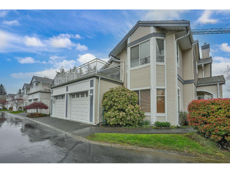
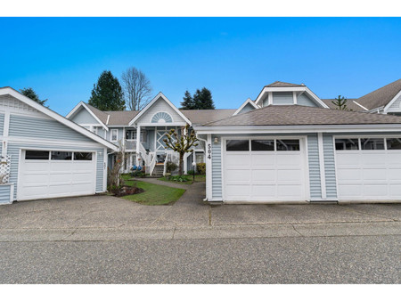
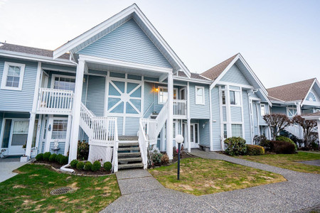
71 2450 Hawthorne Avenue, Port Coquitlam
- Bedrooms: 3
- Bathrooms: 2
- Living area: 1355 sqft
- Type: Townhouse
Source: Public Records
Property Details
Note: This property is not currently for sale or for rent on Ovlix.
We have found 6 Townhomes that closely match the specifications of the property located at 71 2450 Hawthorne Avenue with distances ranging from 2 to 10 kilometers away. The prices for these similar properties vary between 648,888 and 1,049,999, providing a good range for comparison. Moreover, we have also discovered that there are a few open Townhomes in the V3C6B3 postal code area of Port Coquitlam British Columbia Canada.
Property Location
- City: Port Coquitlam
- Country: Canada
- Latitude: 49.2570724
- Province: British Columbia
- Longitude: -122.7870895
- Postal Code: V3C6B3
- Street Name: HAWTHORNE
- Unit Number: 71
- Street Number: 2450
- Street Suffix: Avenue
- Street Address: 71 2450 HAWTHORNE AVENUE
Nearby Places
| Name | Type | Address | Distance |
| Riverside Secondary School | School | 2215 Reeve St | 0.1 km |
| Riverside Secondary School (British Columbia) | It enrolls approximately 1300 students from grades... | 0.2 km | |
| Port Coquitlam | Coquitlam borders it on the north, the Coquitlam R... | 0.7 km | |
| Port Coquitlam railway station | The station opened in 1995, when the West Coast Ex... | 1.1 km | |
| Tri-Cities (British Columbia) | Combined, these five communities have a 2011 popul... | 1.1 km | |
| Riverview Hospital (Coquitlam) | In December 2015, the provincial government announ... | 1.8 km | |
| Boston Pizza | Restaurant | 3025 Lougheed Highway #710 | 2.0 km |
| Coquitlam Central railway station | The platform is located on the south side of the t... | 2.1 km | |
| Coast Meridian Overpass | The bridge has a bike lane on the northbound side ... | 2.1 km | |
| Colony Farm Regional Park | Colony Farm was once one of the most modern and pr... | 2.2 km | |
| Archbishop Carney Regional Secondary School | School | 1335 Dominion Ave | 2.6 km |
| DR. Charles Best Secondary School | School | 2525 Como Lake Ave | 2.6 km |
Demographic Information
Neighbourhood Education
| Master's degree | 15 |
| Bachelor's degree | 150 |
| University / Above bachelor level | 25 |
| University / Below bachelor level | 35 |
| Certificate of Qualification | 60 |
| College | 205 |
| Degree in medicine | 15 |
| University degree at bachelor level or above | 205 |
Neighbourhood Marital Status Stat
| Married | 555 |
| Widowed | 35 |
| Divorced | 90 |
| Separated | 35 |
| Never married | 305 |
| Living common law | 100 |
| Married or living common law | 660 |
| Not married and not living common law | 465 |
Neighbourhood Construction Date
| 1961 to 1980 | 45 |
| 1981 to 1990 | 40 |
| 1991 to 2000 | 335 |
| 2001 to 2005 | 15 |
| 2006 to 2010 | 65 |
| 1960 or before | 15 |