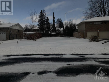
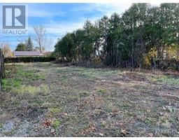
1036 Meadowlands Drive, Ottawa
1036 Meadowlands Drive, Ottawa
×
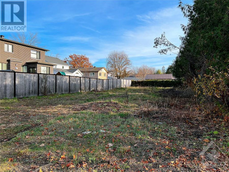
2 Photos
- MLS®: 1369800
- Type: Lots and Land
- Added: 163 days ago
Property Details
Located in Carleton Heights, a great neighborhood. Close to Mooney's Bay Beach, Hog's Back Falls, Rideau Canoe Club, Rideau Canal and Vincent Massey Park. Also close to Merivale Road shopping strip!5 minutes to downtown and Costco. (id:1945)
Property Information
- List AOR: Ottawa
- Tax Year: 2022
- Basement: Not Applicable, Unknown
- Lot Features: Private setting
- Photos Count: 2
- Water Source: Municipal water
- Lot Size Units: acres
- Parcel Number: 040780226
- Tax Annual Amount: 1412
- Lot Size Dimensions: 0.16
- Zoning Description: Residential
 |
This listing content provided by REALTOR.ca has
been licensed by REALTOR® members of The Canadian Real Estate Association |
|---|
Nearby Places
Similar Vacant Lots Stat in Ottawa