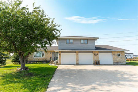
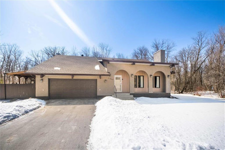
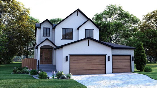
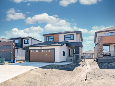
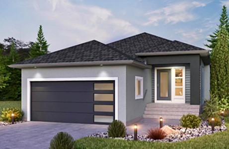
19 Zachary Drive, St Andrews
- Bedrooms: 6
- Bathrooms: 4
- Living area: 3221 sqft
- Type: Residential
Source: Public Records
Property Details
Note: This property is not currently for sale or for rent on Ovlix.
We have found 6 Houses that closely match the specifications of the property located at 19 Zachary Drive with distances ranging from 2 to 10 kilometers away. The prices for these similar properties vary between 499,000 and 1,099,900, providing a good range for comparison. Moreover, we have also discovered that there are a few open Houses in the R1A3B8 postal code area of St Andrews Manitoba Canada.
Property Location
- City: St Andrews
- Country: Canada
- Latitude: 50.046174
- Province: Manitoba
- Longitude: -97.01287
- Postal Code: R1A3B8
- Street Name: ZACHARY
- Street Number: 19
- Street Suffix: Drive
- Community Name: Parkdale
- Neighbourhood: Parkdale
- Street Address: 19 ZACHARY Drive
Nearby Places
| Name | Type | Address | Distance |
| St. Andrews Airport | Airport | St Andrews | 1.7 km |
| St. Andrews Airport | Andrews Airport, (ICAO: CYAV), is a general aviati... | 1.8 km | |
| Saint Andrews School | School | 8 St Andrews Rd | 3.4 km |
| St. Paul (Manitoba electoral district) | It was created by electoral redistribution in 2008... | 4.5 km | |
| Lockport, Manitoba | Andrews (west of the river), and St... | 6.4 km | |
| Half Moon Drive In | Restaurant | 6860 Henderson Hwy | 6.9 km |
| Red River Floodway | It can carry floodwater at a rate of up to 4,000 c... | 7.5 km | |
| Rural Municipality of East St. Paul | It is located north-east of and adjacent to the ci... | 7.7 km | |
| Rural Municipality of West St. Paul | It lies adjacent to the north side of Winnipeg, an... | 8.3 km | |
| Lower Fort Garry National Historic Site | Cafe | 5925 Highway 9 | 9.0 km |
| Kildonan—St. Paul | It has been represented in the House of Commons of... | 9.1 km | |
| Lower Fort Garry | A devastating flood destroyed Fort Garry in 1826, ... | 9.4 km |
Demographic Information
Neighbourhood Education
| Master's degree | 10 |
| Bachelor's degree | 70 |
| University / Above bachelor level | 10 |
| University / Below bachelor level | 15 |
| Certificate of Qualification | 20 |
| College | 130 |
| University degree at bachelor level or above | 80 |
Neighbourhood Marital Status Stat
| Married | 355 |
| Widowed | 20 |
| Divorced | 15 |
| Separated | 10 |
| Never married | 145 |
| Living common law | 65 |
| Married or living common law | 415 |
| Not married and not living common law | 190 |
Neighbourhood Construction Date
| 1961 to 1980 | 80 |
| 1981 to 1990 | 40 |
| 1991 to 2000 | 10 |
| 2001 to 2005 | 45 |
| 2006 to 2010 | 30 |
| 1960 or before | 20 |