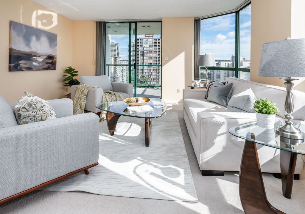
3405 13495 Central Avenue, Surrey
- Bedrooms: 1
- Bathrooms: 1
- Living area: 620 sqft
- Type: Condominium
Source: Public Records
Property Details
Note: This property is not currently for sale or for rent on Ovlix.
We have found 6 Condos that closely match the specifications of the property located at 3405 13495 Central Avenue with distances ranging from 2 to 10 kilometers away. The prices for these similar properties vary between 499,000 and 799,900, providing a good range for comparison. Moreover, we have also discovered that there are a few open Condos in the V3T0K2 postal code area of Surrey British Columbia Canada.
Property Location
- City: SURREY
- Country: Canada
- Latitude: 49.1906395
- Province: British Columbia
- Longitude: -122.8481674
- Postal Code: V3T0K2
- Street Name: CENTRAL
- Unit Number: 3405
- Street Number: 13495
- Street Suffix: Avenue
- Street Address: 3405 13495 CENTRAL AVENUE
Nearby Places
| Name | Type | Address | Distance |
| Surrey City Centre Public Library | The Surrey City Centre Library is the main branch ... | 0.1 km | |
| Surrey Central station | Surrey Central is a station in Surrey, British Col... | 0.1 km | |
| Central City Shopping Centre | Central City Shopping Centre (formerly known as Su... | 0.4 km | |
| Central City Shopping Centre | Store | 10153 King George Blvd | 0.5 km |
| Kwantlen Park Secondary School | École Kwantlen Park Secondary School is a public h... | 0.7 km | |
| Surrey, British Columbia | Surrey is a city in the province of British Columb... | 0.8 km | |
| King George Tower | King George Tower was a proposed skyscraper set to... | 0.9 km | |
| Whalley, British Columbia | Whalley is the city centre of Surrey, British Colu... | 0.9 km | |
| King George station | King George station is located on an elevated port... | 0.9 km | |
| Gateway station (TransLink) | Gateway station is a station on an elevated portio... | 0.9 km | |
| Surrey Memorial Hospital | Surrey Memorial Hospital (SMH) is a publicly funde... | 1.7 km | |
| Queen Elizabeth Secondary School | Queen Elizabeth Secondary is a public high school ... | 1.8 km |