Nw 36 72 17 4, Wandering River
Nw 36 72 17 4, Wandering River
×
4 Photos
- MLS®: a2074015
- Type: Lots and Land
- Added: 250 days ago
Property Details
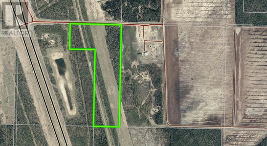
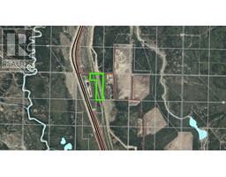
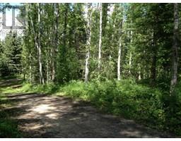
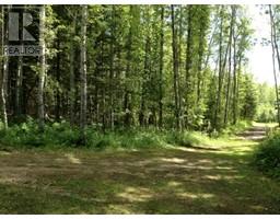
49.88 acres of ideal recreational land, with approximately half cleared and half treed. This land is located in the pipeline corridor, which means, some future revenue "may" be expected. Example, the pipeline companies may do test holes and for that small disbursements are paid to the owners for any soil disturbances. In the meantime, you have access to 49.88 acres of land for camping, quadding, target shooting, hunting or setting up base camp. This property is adjacent to a gas plant but is mostly surrounded by crown land and great spot for recreation with a group. Approx. 20 minutes north of the hamlet of Wandering River on the East side of the Hwy. (id:1945)
Property Information
- Tax Year: 2022
- Photos Count: 4
- Lot Size Units: acres
- Parcel Number: 0017964735
- Common Interest: Freehold
- Tax Annual Amount: 14.2
- Lot Size Dimensions: 49.88
- Zoning Description: AG
 |
This listing content provided by REALTOR.ca has
been licensed by REALTOR® members of The Canadian Real Estate Association |
|---|