3250 264 Street, Langley

3250 264 Street, Langley, BC V4W3E9 Photo 1

9 Photos

3250 264 Street, Langley, BC V4W3E9 Photo 2
3250 264 Street, Langley, BC V4W3E9 Photo 3
3250 264 Street, Langley, BC V4W3E9 Photo 4
3250 264 Street, Langley, BC V4W3E9 Photo 5
3250 264 Street, Langley, BC V4W3E9 Photo 6
3250 264 Street, Langley, BC V4W3E9 Photo 7
  • MLS®: r2810452
  • Type: Lots and Land
  • Added: 243 days ago

Property Details

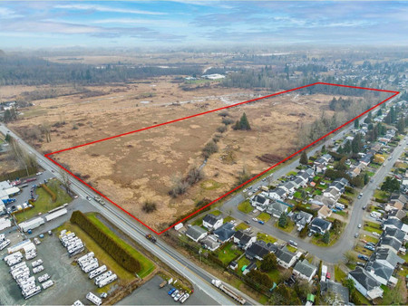
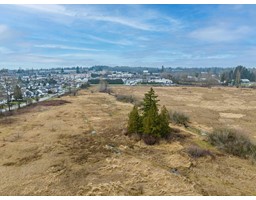
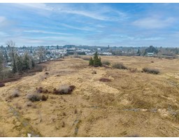
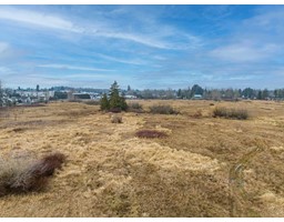
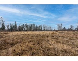
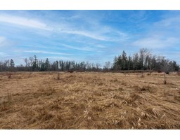
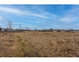
3250 264 Street provides the opportunity to acquire approximately 43.99 acres rural zoned Site in an extremely strategic location. Although zoned RU-3, the neighboring properties to the west of the Property are "Industrial" or "Light Industrial uses. It is situated on 264 Street and one block north of the Fraser Highway. The Township's southern boundary is the United States Border and is well positioned to utilize these strategic transportation corridors. Aldergrove is a mix of Rural, Residential, and business uses on the Township of Langley's eastern border. Gloucester Industrial Park, retail shops and parkland. (id:1945)

Property Information

  • Tax Year: 2023
  • Photos Count: 9
  • Lot Size Units: square feet
  • Common Interest: Freehold
  • Tax Annual Amount: 16347.32
  • Lot Size Dimensions: 1916204.4
This listing content provided by REALTOR.ca has been licensed by REALTOR®
members of The Canadian Real Estate Association

Nearby Places

Name Type Address Distance
Boston Pizza Restaurant 900-26310 Fraser Hwy 0.1 km
Aldergrove Community Secondary School ACSS was one of the first schools in BC to have a ... 1.0 km
Aldergrove Community Secondary School School Langley 1.1 km
Aldergrove, British Columbia The community is urban in nature and, although not... 1.4 km
Naval Radio Section Aldergrove NRS Aldergrove is the Royal Canadian Navy's primar... 2.6 km
Greater Vancouver Zoo Zoo 5048 264 St 3.2 km
Fraser Valley Adventist Academy The school is part of the Seventh-day Adventist wo... 3.2 km
Greater Vancouver Zoo The Greater Vancouver Zoo is a 120-acre (49 ha) zo... 3.5 km
Langley (electoral district) It is a 327 km² riding with 117,858 people located... 5.3 km
Aberdeen, Abbotsford Aberdeen is a neighbourhood on the west side of Ab... 5.7 km
Fraser Lowland state of Washington... 6.2 km
0 Avenue The road is a haven for smugglers, even though the... 6.5 km

Demographic Information

Neighbourhood Education

Master's degree 10
Bachelor's degree 10
University / Below bachelor level 15
Certificate of Qualification 15
College 85
University degree at bachelor level or above 20

Neighbourhood Marital Status Stat

Married 255
Widowed 20
Divorced 35
Separated 10
Never married 125
Living common law 60
Married or living common law 320
Not married and not living common law 185

Neighbourhood Construction Date

1961 to 1980 105
1981 to 1990 25
1991 to 2000 55
2006 to 2010 10
1960 or before 15
Nearby Cities Listings Avg. price
Surrey 2539 $1.623.029
Burnaby 820 $1.399.109
White Rock 209 $1.874.865
Pitt Meadows 71 $1.118.138
Port Coquitlam 171 $1.338.232
Delta 261 $1.745.025
Richmond 732 $1.627.776
New Westminster 265 $1.474.465
Popular Cities Listings Avg. price
Coquitlam 503 $1.647.104
Vancouver 2742 $2.142.978
Abbotsford 688 $1.400.450
North Vancouver 471 $1.780.437
West Vancouver 338 $4.407.831
Chilliwack 555 $1.062.434
Maple Ridge 674 $1.478.969
Victoria 434 $986.503
26840 Alder Drive, Langley 26850 34 Avenue, Langley 26879 33 A Avenue, Langley 27188 28 Avenue, Langley 26987 28 Avenue, Langley 26782 30 Avenue, Langley 26844 34 Avenue, Langley 26870 32 Avenue, Langley