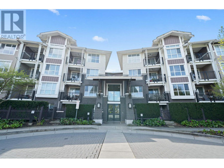
410 13321 102 A Avenue, Surrey
- Bedrooms: 1
- Bathrooms: 1
- Living area: 586 sqft
- Type: Apartment
Source: Public Records
Property Details
Note: This property is not currently for sale or for rent on Ovlix.
We have found 6 Condos that closely match the specifications of the property located at 410 13321 102 A Avenue with distances ranging from 2 to 10 kilometers away. The prices for these similar properties vary between 478,888 and 599,900, providing a good range for comparison. Moreover, we have also discovered that there are a few open Condos in the V3T1P6 postal code area of Surrey British Columbia Canada.
Nearby Places
| Name | Type | Address | Distance |
| Central City Shopping Centre | Central City Shopping Centre (formerly known as Su... | 0.3 km | |
| Surrey City Centre Public Library | The Surrey City Centre Library is the main branch ... | 0.4 km | |
| Surrey Central station | Surrey Central is a station in Surrey, British Col... | 0.4 km | |
| Kwantlen Park Secondary School | École Kwantlen Park Secondary School is a public h... | 0.5 km | |
| Central City Shopping Centre | Store | 10153 King George Blvd | 0.7 km |
| Surrey, British Columbia | Surrey is a city in the province of British Columb... | 0.7 km | |
| King George Tower | King George Tower was a proposed skyscraper set to... | 1.0 km | |
| King George station | King George station is located on an elevated port... | 1.0 km | |
| Whalley, British Columbia | Whalley is the city centre of Surrey, British Colu... | 1.1 km | |
| Gateway station (TransLink) | Gateway station is a station on an elevated portio... | 1.1 km | |
| Surrey Memorial Hospital | Surrey Memorial Hospital (SMH) is a publicly funde... | 1.7 km | |
| Queen Elizabeth Secondary School | Queen Elizabeth Secondary is a public high school ... | 1.7 km |
Demographic Information
Neighbourhood Education
| Master's degree | 170 |
| Bachelor's degree | 295 |
| University / Above bachelor level | 50 |
| University / Below bachelor level | 95 |
| Certificate of Qualification | 35 |
| College | 300 |
| Degree in medicine | 10 |
| University degree at bachelor level or above | 525 |
Neighbourhood Marital Status Stat
| Married | 700 |
| Widowed | 20 |
| Divorced | 105 |
| Separated | 60 |
| Never married | 710 |
| Living common law | 245 |
| Married or living common law | 940 |
| Not married and not living common law | 890 |
Neighbourhood Construction Date
| 1961 to 1980 | 20 |
| 1981 to 1990 | 25 |
| 1991 to 2000 | 35 |
| 2001 to 2005 | 35 |
| 2006 to 2010 | 305 |
| 1960 or before | 15 |