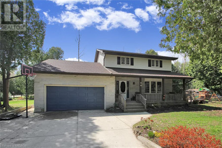
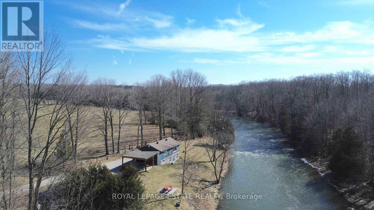
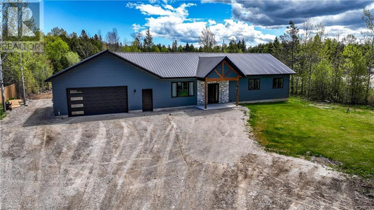
277 Ogimah Road, Chief S Point Indian Reserve 28
- Bedrooms: 4
- Bathrooms: 2
- Living area: 2181 sqft
- Type: Residential
Source: Public Records
Property Details
Note: This property is not currently for sale or for rent on Ovlix.
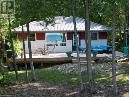
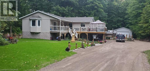
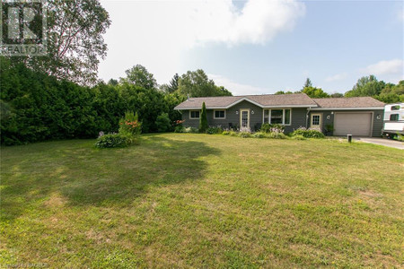
We have found 6 Houses that closely match the specifications of the property located at 277 Ogimah Road with distances ranging from 2 to 10 kilometers away. The prices for these similar properties vary between 329,900 and 699,000, providing a good range for comparison. Moreover, we have also discovered that there are a few open Houses in the N0H2G0 postal code area of Chief S Point Indian Reserve 28 Ontario Canada.
Property Location
- City: Chief's Point Indian Reserve #28
- Country: Canada
- Latitude: 44.66380963
- Province: Ontario
- Longitude: -81.28134807
- Postal Code: N0H2G0
- Street Name: OGIMAH
- Subdivision: Native Leased Lands
- Street Number: 277
- Street Suffix: Road
- Street Address: 277 OGIMAH Road
Nearby Places
| Name | Type | Address | Distance |
| Sauble River (Ontario) | The Sauble River is a river in Bruce County and Gr... | 0.3 km | |
| Kit-Wat Marina Motel Restaurant | Real estate agency | 71 Sauble Falls Rd | 0.7 km |
| Sauble Falls Provincial Park | Park | Wiarton | 2.2 km |
| Chief's Point 28 | ... | 2.2 km | |
| Sauble Falls Provincial Park | The campground consists of two sections divided by... | 2.4 km | |
| Sauble Falls Tent & Trailer Camp | Campground | 849 Sauble Falls Pkwy | 2.7 km |
| Rankin River | The river is in the Lake Huron drainage basin and ... | 2.9 km | |
| Sauble Lodge Motor Inn | Bar | 213 2nd Ave N | 3.1 km |
| Sauble Beach, Ontario | It is on the eastern shore of Lake Huron, on the n... | 3.2 km | |
| Woodland Park | Park | 47 Sauble Falls Pky RR 1 | 3.6 km |
| Winding River Campground | Campground | 94 Fedy Dr | 3.6 km |
| Centennial Motel | Restaurant | 10 Sauble Falls | 3.9 km |
Demographic Information
Neighbourhood Education
| Bachelor's degree | 20 |
| University / Below bachelor level | 10 |
| Certificate of Qualification | 15 |
| College | 55 |
| University degree at bachelor level or above | 25 |
Neighbourhood Marital Status Stat
| Married | 165 |
| Widowed | 25 |
| Divorced | 45 |
| Separated | 10 |
| Never married | 135 |
| Living common law | 110 |
| Married or living common law | 270 |
| Not married and not living common law | 210 |
Neighbourhood Construction Date
| 1961 to 1980 | 45 |
| 1981 to 1990 | 55 |
| 1991 to 2000 | 45 |
| 2001 to 2005 | 15 |
| 2006 to 2010 | 35 |
| 1960 or before | 25 |