4973 Old Brock Rd, Other
-
Bedrooms: 3
-
Bathrooms: 3
-
Type: Residential
-
Added: 253 days ago
-
Type: Residential
-
Listed by: Point2
Property Details
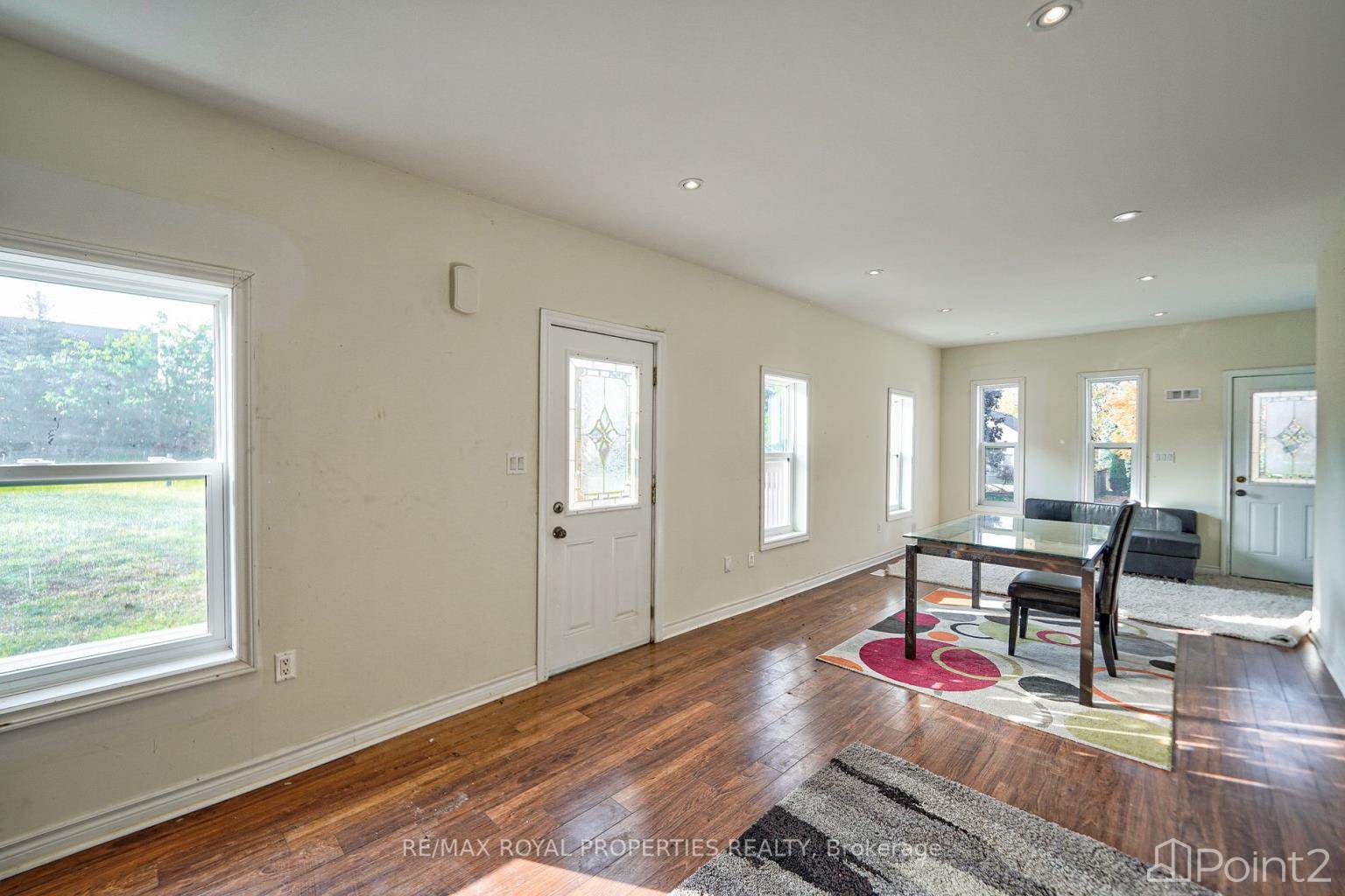
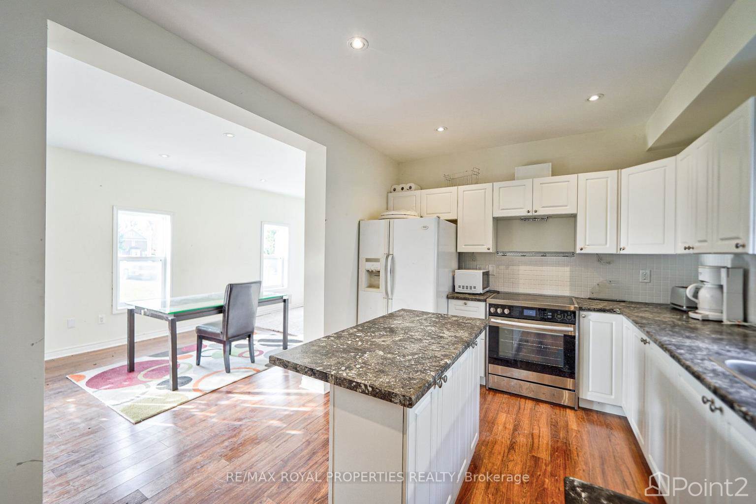
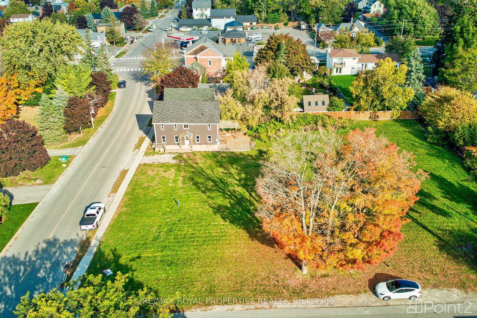
Welcome to 4973 Old Brock Rd, one of Durham Region's Gem. Great for developers or End Users. Huge property, recently zoning changed to Residential. 3-4 Homes can be built. 10 minutes to Stouffville and 35 Minutes to Toronto. Services are on the way near to subdivisions. Good investment, great property on desired location! Rare find, must see.To view this home call or text SHELBY 905-910-1237**NOT INTENDED TO SOLICIT BUYERS ALREADY UNDER CONTRACT**- if you already have a real estate agent please refer to them for informationSHELBY TANYA647 825 8468PRABHA416 357 5327
Best Mortgage Rates
Nearby Places
| Name |
Type |
Address |
Distance |
| Reesor Farm Market |
Grocery or supermarket |
10825 Ninth Line |
10.4 km |
| Nature's Bounty |
Food |
651 Scugog Line 2 |
12.1 km |
| Markham Stouffville Hospital |
Hospital |
381 Church St |
12.7 km |
| Heber Down Conservation Area |
Park |
Whitby |
12.8 km |
| St. Brother André Catholic High School |
School |
6160 16 Ave E |
13.5 km |
| Pickering High School |
School |
180 Church St N |
13.8 km |
| Whittamore's Berry Farm |
Food |
8100 Steeles Ave E |
13.8 km |
| Wooden Sticks Golf Inc |
Restaurant |
40 Elgin Park Dr |
13.8 km |
| Markham Museum |
Museum |
9350 Markham Rd |
13.9 km |
| Mandarin Restaurant |
Meal takeaway |
88 Copper Creek Dr |
14.1 km |
| Markham District High School |
School |
89 Church St |
14.1 km |
| Safari Bar Grill Billiards |
Bar |
60 Randall Dr |
14.3 km |
Additional Information about 4973 Old Brock Rd, Other, ON,
L1Y1A9
This House at 4973 Old Brock Rd Other, ON with MLS Number null listed by Prabha & Shelby Realtrium - Realtrium Realty LTD on Other market 253 days ago at $1,598,900
We have found 6 Houses that closely match the specifications of the property located at 4973 Old Brock Rd with distances ranging from 2 to 10 kilometers away. The prices for these similar properties vary between 1,049,000 and 1,398,000.
Estimated monthly mortgage payment for the property located at 4973 Old Brock Rd. The current price of the property is $1,598,900, and the mortgage rate being used for the calculation is 4.44%, which is a rate offered by Ratehub.ca. Assuming a mortgage with a 18% down payment, the total amount borrowed would be $1,311,098. This would result in a monthly mortgage payment of $7,477 over a 25-year amortization period.