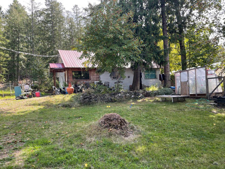
7619 Upper Balfour Road, Balfour
- Bedrooms: 3
- Living area: 1076 sqft
- Type: Residential
Source: Public Records
Property Details
Note: This property is not currently for sale or for rent on Ovlix.
We have found 1 Houses that closely match the specifications of the property located at 7619 Upper Balfour Road with distances ranging from 2 to 9 kilometers away. The prices for these similar properties vary between 329,000 and 329,000, providing a good range for comparison. Moreover, we have also discovered that there are a few open Houses in the V0G1C0 postal code area of Balfour British Columbia Canada.
Property Location
- City: Balfour
- Country: Canada
- Latitude: 49.6257286
- Province: British Columbia
- Longitude: -116.9726486
- Postal Code: V0G1C0
- Street Name: UPPER BALFOUR ROAD
- Street Number: 7619
- Street Address: 7619 UPPER BALFOUR ROAD
Nearby Places
| Name | Type | Address | Distance |
| Balfour Beach Inn | Restaurant | 8406 Busk | 0.8 km |
| Dock 'n' Duck Pub, Family Grill, Lodge | Meal takeaway | 7924 British Columbia 3A | 0.9 km |
| Balfour, British Columbia | This marine link of the British Columbia highway s... | 0.9 km | |
| Procter, British Columbia | The settlement was named either for Thomas Gregg P... | 1.2 km | |
| Queens Bay | Queens Bay is an unincorporated settlement and for... | 3.9 km | |
| Kootenay Lake | Kootenay Lake has a year-round toll-free ferry tha... | 4.1 km | |
| Kootenay Lake Ferry | It is the longest free ferry in the world... | 5.3 km | |
| Pilot Bay, British Columbia | In the early 1890s, the Hendryx interests built a ... | 7.1 km | |
| Toad Rock Motorcycle Campground | Campground | 2865 Toad Rock Road, | 7.8 km |
| Pilot Bay Provincial Park | Park | Kootenay Bay | 7.9 km |
| Kootenay Bay | The ferry, operated by BC Ferries, crosses the lak... | 10.0 km | |
| Kokanee Creek Provincial Park | Park | Central Kootenay E | 10.8 km |