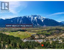
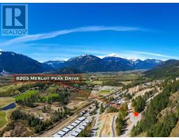
8203 Merlot Peak Drive, Pemberton
- Type: Lots and Land
- Added: 11 months ago
- Updated: 1 month ago
- Last Checked: 23 hours ago
- Listed by: Angell Hasman & Associates Realty Ltd.
Listing description
This Vacant Lot at 8203 Merlot Peak Drive Pemberton, BC with the MLS Number r2960682 listed by Dan Scarratt - Angell Hasman & Associates Realty Ltd. on the Pemberton market 11 months ago at $464,000.
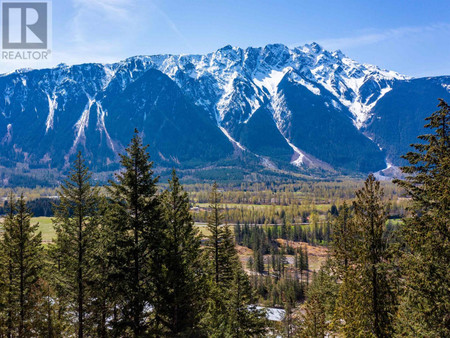
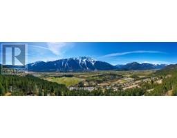
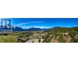
Welcome to Sunstone, where luxury and nature converge. This incredible south-facing building lot boasts an impressive 13,455 square feet of space, providing ample room for your dream home, garden, and more. You'll enjoy breathtaking views of Mount Currie and plenty of sunshine all year round. For those who love to stay active and enjoy the great outdoors, the property has easy access to the Mackenzie trail network, as well as the Friendship and Sea to Sky trails, and the developing recreation area with soccer pitches and the mountain bike skills park. GST has been paid and zoning allows for a carriage house, providing additional space for guests, a home office, or a rental unit. Don't miss out on this opportunity to build your dream home in one of Pemberton's most desirable communities. (id:1945)

This listing content provided by
REALTOR.ca
has been licensed by REALTOR®
members of The Canadian Real Estate Association
members of The Canadian Real Estate Association
Exterior & Lot Features
Learn about the exterior and lot specifics of 8203 Merlot Peak Drive
Location & Community
Understand the neighborhood and community
Tax & Legal Information
Get tax and legal details applicable to 8203 Merlot Peak Drive
Additional Features
Explore extra features and benefits
Nearby Listings Stat Estimated price and comparable properties near 8203 Merlot Peak Drive
Nearby Places Nearby schools and amenities around 8203 Merlot Peak Drive
Price History
January 28, 2025
by Angell Hasman & Associates Realty Ltd.
$464,000