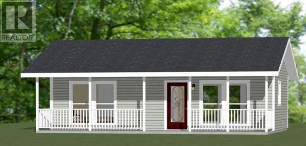
6 Radar Road, Port Blandford
- Bedrooms: 3
- Bathrooms: 1
- Living area: 2200 sqft
- Type: Residential
Source: Public Records
Property Details
Note: This property is not currently for sale or for rent on Ovlix.
We have found 1 Houses that closely match the specifications of the property located at 6 Radar Road with distances ranging from 2 to 1 kilometers away. The prices for these similar properties vary between 169,000 and 169,000, providing a good range for comparison. Moreover, we have also discovered that there are a few open Houses in the A0C2G0 postal code area of Port Blandford Newfoundland Canada.
Property Location
- City: PORT BLANDFORD
- Country: Canada
- Latitude: 48.354274
- Province: Newfoundland & Labrador
- Longitude: -54.165983
- Postal Code: A0C2G0
- Street Name: RADAR
- Street Number: 6
- Street Suffix: Road
- Street Address: 6 RADAR Road
Nearby Places
| Name | Type | Address | Distance |
| Port Blandford | 7 on Clode Sound... | 0.5 km | |
| Hopkin's & Quinton Fisheries Ltd | Food | Wharf Rd | 0.6 km |
| Ivany's Cove | Ivany's Cove is a settlement in Newfoundland and L... | 1.8 km | |
| Twin Rivers Golf Course | The Twin Rivers Golf Course is part of the Terra N... | 4.6 km | |
| The Lakeside at Thorburn | Rv park | Trans-Canada Hwy | 7.2 km |
| Thorburn Lake Waterdome | Airport | Clarenville | 9.3 km |
| Thorburn Lake Water Aerodrome | Thorburn Lake Water Aerodrome (TC LID: CCW5), is a... | 9.8 km | |
| Discovery Trail Farm Ltd. | Restaurant | Newfoundland and Labrador 233 | 19.7 km |
| Clarenville Airport | Airport | Charleston | 20.0 km |
| The Red Rooster Eatery | Restaurant | Lethbridge | 20.3 km |
| Eastern School District | School | Lethbridge | 20.3 km |
| George's Brook, Newfoundland and Labrador | By 1956 it had a population of 197... | 20.4 km |
Demographic Information
Neighbourhood Education
| Certificate of Qualification | 35 |
| College | 70 |
| University degree at bachelor level or above | 10 |
Neighbourhood Marital Status Stat
| Married | 365 |
| Widowed | 45 |
| Divorced | 10 |
| Never married | 75 |
| Living common law | 35 |
| Married or living common law | 400 |
| Not married and not living common law | 130 |
Neighbourhood Construction Date
| 1961 to 1980 | 95 |
| 1981 to 1990 | 55 |
| 1991 to 2000 | 15 |
| 2006 to 2010 | 15 |
| 1960 or before | 55 |