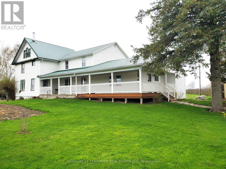
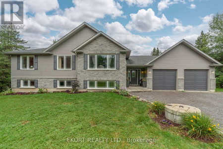
132 Salem Road, Stirling
- Bedrooms: 7
- Bathrooms: 4
- Living area: 3771.44 sqft
- Type: Residential
Source: Public Records
Property Details
Note: This property is not currently for sale or for rent on Ovlix.
We have found 6 Houses that closely match the specifications of the property located at 132 Salem Road with distances ranging from 2 to 10 kilometers away. The prices for these similar properties vary between 699,990 and 1,200,000, providing a good range for comparison. Moreover, we have also discovered that there are a few open Houses in the K0K3E0 postal code area of Stirling Ontario Canada.
Property Location
- City: Stirling
- Country: Canada
- Latitude: 44.35590252
- Province: Ontario
- Longitude: -77.57980832
- Postal Code: K0K3E0
- Street Name: SALEM
- Subdivision: Rawdon Ward
- Street Number: 132
- Street Suffix: Road
- Street Address: 132 SALEM Road
Nearby Places
| Name | Type | Address | Distance |
| Stirling Creamery Ltd | Food | 1 West Front | 7.1 km |
| Stirling Public School | School | 107 St James Street | 7.3 km |
| Ivanhoe Cheese | Food | 11301 Hwy 62 N | 9.5 km |
| Church-Key Brewing Company | Liquor store | 1678 County Rd | 12.4 km |
| Stirling Airport | Airport | Airport Rd | 12.7 km |
| Stirling Aerodrome | The airport is operated by the Oak Hills Flying Cl... | 12.8 km | |
| Rancho Tranquilo | Food | 6490 Stirling Marmora Rd | 13.5 km |
| Crowe Bridge Park | Park | 670 Crowe River Rd | 14.0 km |
| Crowe River | It is in the Lake Ontario drainage basin and is a ... | 14.8 km | |
| Iroquois Trail Camp Site | Campground | 484-A Frankford-Stirling | 14.9 km |
| Cole's Point Resort & Trailer Park | Park | 332 Coles Point Rd | 15.3 km |
| Marmora KOA | Campground | 178 Koa Campground Rd | 15.2 km |