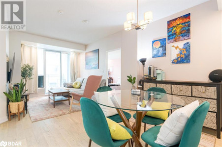
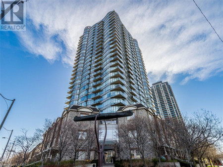
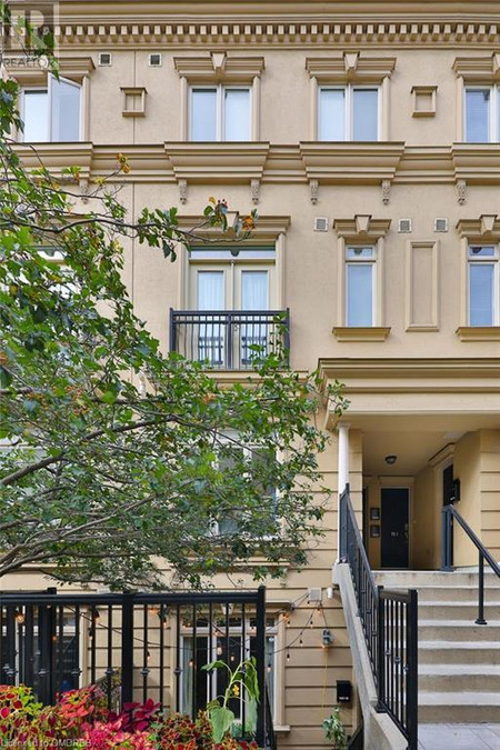
$1.099.900
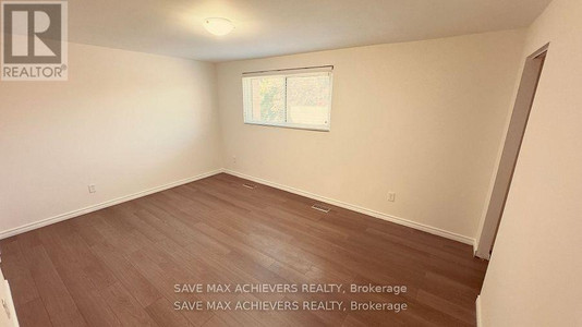
1402 A Eglinton Avenue W, Toronto
2 beds 3 baths 1537 sqft • Townhouse
Added by Faris Team Real Estate Brokerage 12 hours ago
Whether you're interested in viewing Toronto real estate or homes for sale in any of your favorite neighborhoods: Tcw 1 Waterfront Communities C 1, Waterfront Communities C1, Agincourt South-Malvern West, Bay Street Corridor, Annex, Twmc Mimico you'll find what you're looking for. Currently on Toronto real estate marked listed 3364 single family homes for sale with price range from 1$ to 23,423,423$ with average price 906,399$ for 2 bedroom houses.
Whether you're a parent with a brood of eager learners or a student looking to further your education, Toronto's got you covered with a diverse array of schools that cater to every academic taste. Topping the charts, we've got the University of Toronto with its global reputation for research and teaching excellence. But that's not all – high-performing secondary schools like Earl Haig Secondary School and North Toronto Collegiate Institute are bustling hubs of young talent. Elementary schools? Pff, in Toronto, places like Blythwood Junior Public School and Jackman Avenue Junior Public School are practically nurturing Nobel laureates in the making. Dive into the scene, and you'll find that education here isn't just a commitment, it's a lifestyle.
Get this – Toronto isn't just Canada's biggest city; it's a cultural mosaic like no other. We're talking about a place where over 200 languages are chatted on the streets, in cafes, and in business meetings. But let's lay down some numbers to see what's really cooking in the 6ix.
| Total Population | 2.93 million |
|---|---|
| Median Age | 39 years |
| Diversity Index | 9 out of 10 residents are immigrants or second-generation individuals |
| Most Spoken Languages (other than English) | Cantonese, Mandarin, Punjabi, Spanish, Italian |
| Median Household Income | $65,829 |
Toronto's awesome and all, but the fun doesn't stop at its borders. Take a short drive out, and you’ll bump into Mississauga with its swanky malls and bustling business centers. Head east, and you'll hit Scarborough, where the bluffs are a must-see. Up north? Vaughan's where you can get your thrill on at Canada's Wonderland. And let's not forget about Markham, a tech hub with a cozy suburban feel. These cities aren’t just neighbors; they're like the cool cousins with their own quirky vibes.
Talk about choice! In Toronto, neighborhoods are like different worlds – each with its own personality. Whether you're looking for the artsy beats of West Queen West or the stylish strides of Yorkville, the city's got a spot for you. But hey, don't just take my word for it; let's see what the numbers say.
| Neighbourhood | Vibe | Average Home Price | Rent for 2-bedroom |
|---|---|---|---|
| Kensington Market | Bohemian | $1.2M | $2,200 |
| The Annex | Historic & Hip | $1.5M | $2,500 |
| Liberty Village | Trendy & Lively | $800K | $2,100 |
| Distillery District | Chic & Cultural | $900K | $2,300 |
Buckle up, because Toronto's real estate market is quite the rollercoaster! It's a hot topic at every dinner table – and for a good reason. The city's market has been known to surprise, delight, and sometimes, let's be honest, baffle both buyers and sellers. The past year alone has been a spectacle of shifting trends with whispers of bidding wars, cooling periods, and everything in between. But hey, nothing speaks louder than the cold, hard stats, so let's take a gander.
| Year | Average Selling Price | Year-over-Year Change | Number of Sales |
|---|---|---|---|
| 2023 | $1,050,000 | 7% | 9,000 |
| 2022 | $980,000 | 4% | 8,500 |
| 2021 | $940,000 | 10% | 10,000 |
If you're mulling over whether to plant roots or float around in Toronto, you're not alone. It's the classic urban dilemma – to buy or not to buy? Here's the scoop: buying in Toronto is like getting a golden ticket to Wonkaland, except it's real, and it appreciates over time. But it's pricey, and not everyone's ready to lay down that kind of dough. Renting, on the other hand, offers flexibility – perfect for those who love to live with a bit less commitment. Choices, choices – but in Toronto, either way, you're winning.
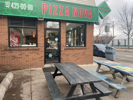
So, you're in Toronto – the land of Drake, Raptors, and that big pointy tower – what's next? Grab a peameal bacon sandwich at St. Lawrence Market, hit the Art Gallery of Ontario, or take a stroll along the Harbourfront. But that's just a teaser. Toronto's a whole world packaged in a city – from the endless eats of Chinatown to the serene trails of the Don Valley. And when night falls? The city shines with bars and clubs that keep the beats going until the wee hours. Trust me, boredom is not on the itinerary here.
Alright, first-time home buyers in Toronto, strap in. This city's market can be as wild as a raccoon in your trash can at midnight. But fear not – with a bit of know-how and the right guide, you can navigate this concrete jungle. First things first, get yourself a savvy realtor who knows the 416 like the back of their hand. Crunch some numbers for a down payment, brace for a bidding war, and hey, don't forget to check out the neighborhood vibes. Remember, buying a home here isn't just a transaction, it's a rite of passage. Welcome to the club!
In addition to 3449 Houses in Toronto, we also found 2997 Condos, 971 Commercial listings, 493 Condos, 368 Townhomes, 58 Vacant land listings, 19 undefined, 18 Duplex listings, 9 undefined, 9 Other. Research Toronto real estate market trends and find homes for sale. Search for new homes, open houses, recently sold homes and reduced price real estate in Toronto. Each sale listing includes detailed descriptions, photos, amenities and neighborhood information for Toronto.
| Nearby Cities | Listings | Avg. price |
|---|---|---|
| Toronto C 10 Real Estate | 115 | $991.765 |
| Toronto C 09 Real Estate | 30 | $3.320.153 |
| Toronto C 11 Real Estate | 61 | $1.353.700 |
| Toronto C 03 Real Estate | 87 | $2.549.101 |
| Toronto C 02 Real Estate | 120 | $2.090.607 |
| Toronto C 04 Real Estate | 74 | $2.291.489 |
| Toronto C 08 Real Estate | 412 | $842.619 |
| Toronto E 03 Real Estate | 75 | $1.547.722 |
| Popular Cities | Listings | Avg. price |
|---|---|---|
| Toronto C 01 Real Estate | 656 | $1.069.955 |
| Markham Real Estate | 774 | $1.314.793 |
| Vaughan Real Estate | 1001 | $1.663.189 |
| Richmond Hill Real Estate | 655 | $1.875.934 |
| Mississauga Real Estate | 1781 | $1.262.292 |
| Brampton Real Estate | 1539 | $1.210.387 |
| Other Real Estate | 1310 | $866.568 |
| Cambridge Real Estate | 525 | $988.918 |